

Easy
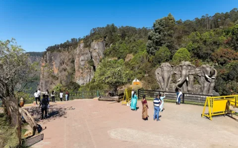
Kodaikanal Group Trip from Bangalore
Overview of the Kodaikanal Group Trip from Bangalore Kodaikanal Group Trip from Bangalore runs 1N/2D from Bangalore, graded…
Next Departure
27/11/2026
20 seats left
Tadiandamol Trek runs 1 day in Karnataka, graded Easy, from Rs 3,200 per person.
Tadiandamol, at 1,748 metres, is the highest peak in Kodagu district — better known by its colonial-era name, Coorg — and the trek to its summit has become one of the most consistently recommended short treks in Karnataka, prized as much for the journey through the district’s famous coffee country as for the peak itself. Because the climb can be completed comfortably within a single day, Tadiandamol has become a popular weekend option for trekkers based in Bangalore and Mysore, often combined with a broader Coorg itinerary that includes coffee estate stays, waterfall visits, and wildlife sanctuary excursions in the surrounding district. For a genuinely rewarding introduction to Western Ghats trekking without a major time commitment, few routes in Karnataka match Tadiandamol’s blend of accessible scenery, cultural depth, and reliably spectacular sunrise views. This cultural texture, layered onto the trek’s genuinely striking natural scenery, is part of what distinguishes Tadiandamol from other short Western Ghats treks. The trek typically begins near the village of Kakkabe, home to the Igguthappa temple, one of Kodagu’s most significant local shrines and a common stop for trekkers before setting out. From here the trail climbs steadily, the neat rows of cultivated coffee gradually giving way to denser natural forest and, eventually, the open shola-grassland ecosystem characteristic of the higher Western Ghats — the same distinctive mosaic of stunted forest patches and rolling grass slopes found at Kudremukh and other high points across the range. The summit itself is marked by a small stone platform, often used by trekking groups for a shared breakfast before the descent.
The walking route is about 11 km both ways, taking roughly four and a half hours to climb and three hours to descend. Nalknad Palace is the usual base, and permits are issued through the Aranya Vihaara portal under Kodagu district treks. The trail runs through forest, then grassland, then a ridge walk to the summit. A pole with a board marks the highest point. The summit view takes in tea and coffee estates, rolling hills and the forested ridgelines of the Western Ghats. Water is available from streams and a waterfall on the route, though purification is advisable. The best window runs from June to February, with the monsoon months greenest and the winter months clearest.
At this height the limit on the Tadiandamol Trek is fitness and heat rather than oxygen, which makes the descent the part people underestimate.
The Tadiandamol Trek assembles at Bangalore, and the day numbering runs from that point. Reporting times and the exact pickup point for the Tadiandamol Trek are confirmed on booking.
The Tadiandamol Trek is a realistic first outing, since its 1 day are short enough that fitness is not the barrier. Families with older children and anyone returning to walking after a break fit the Tadiandamol Trek comfortably. Solo travellers move inside a led group on the Tadiandamol Trek, so the pace is collective rather than personal.
Heat and sun are bigger risks than cold on the Tadiandamol Trek, so a cap, sunscreen and more water than feels necessary matter most. Footwear decides the day on the Tadiandamol Trek: loose stone and wet ground cause most slips, and a worn sole is the usual reason people struggle on the descent. Carry two litres of water each on the Tadiandamol Trek, a small first-aid kit, a head torch for pre-dawn walking, and food already tested on a training walk.
The main risks on the Tadiandamol Trek at this height are slips on wet sections and dehydration on exposed stretches, both prevented by steady pacing. A certified leader carries first aid and safety kit on the Tadiandamol Trek and reviews the forecast each morning, so the plan stays provisional until conditions are known. Travel insurance that covers trekking at this altitude is worth the small extra cost and is not part of the Tadiandamol Trek price.
The Rs 3,200 price of the Tadiandamol Trek covers accommodation on the itinerary, the listed meals, a certified leader with support crew, applicable permits and entry fees, and the safety equipment carried. Excluded from the Tadiandamol Trek are travel to the assembly point unless the itinerary says otherwise, personal kit and clothing, insurance, and anything the inclusions list does not name.
Coorg’s identity is inseparable from coffee cultivation, and much of the trek’s lower approach winds directly through working estates, shaded by silver oak and jackfruit trees planted specifically to canopy the coffee bushes beneath. The trail itself, while steady in its climb, involves no technical sections, keeping the overall difficulty comfortably within reach of most reasonably fit visitors.
Browsing by region or activity is often faster than reading individual pages, so start with Karnataka. The closest alternatives to the Tadiandamol Trek are Skandagiri Trek, Makalidurga trek and Savandurga Trek, which suit anyone comparing dates or a slightly different grade.
Tadiandamol, at 1,748 metres, is the highest peak in Kodagu district — better known by its colonial-era name, Coorg — and the trek to its summit has become one of the most consistently recommended short treks in Karnataka, prized as much for the journey through the district’s famous coffee country as for the peak itself. Coorg’s identity is inseparable from coffee cultivation, and much of the trek’s lower approach winds directly through working estates, shaded by silver oak and jackfruit trees planted specifically to canopy the coffee bushes beneath.
The trek typically begins near the village of Kakkabe, home to the Igguthappa temple, one of Kodagu’s most significant local shrines and a common stop for trekkers before setting out. From here the trail climbs steadily, the neat rows of cultivated coffee gradually giving way to denser natural forest and, eventually, the open shola-grassland ecosystem characteristic of the higher Western Ghats — the same distinctive mosaic of stunted forest patches and rolling grass slopes found at Kudremukh and other high points across the range.
Mist is a near-constant companion on this trek for much of the year, particularly during and immediately after the monsoon, rolling across the grassland slopes in slow, shifting waves that alternately reveal and obscure the surrounding hills — a defining atmospheric quality that has made Tadiandamol a particular favourite among photographers, who often plan visits specifically around the interplay of mist, early light, and the peak’s rolling green terrain. The trail itself, while steady in its climb, involves no technical sections, keeping the overall difficulty comfortably within reach of most reasonably fit visitors.
From the summit, on a clear morning, the panorama extends across much of Kodagu district and, on exceptionally good days, toward the Arabian Sea coastline in the distance — a view considered among the finest sunrise vantage points in Karnataka, drawing trekkers who make the pre-dawn climb specifically to catch the moment the surrounding hills emerge from shadow as the sun clears the eastern ridgeline. The summit itself is marked by a small stone platform, often used by trekking groups for a shared breakfast before the descent.
Kodagu’s broader Kodava community, to which much of the local land and coffee estates belong, maintains a distinct cultural identity within Karnataka, with its own customs, cuisine, and martial traditions that trekkers often encounter in smaller ways throughout the journey — a homestay breakfast featuring the region’s distinctive pandi curry, or a passing conversation with an estate worker about the season’s coffee harvest. This cultural texture, layered onto the trek’s genuinely striking natural scenery, is part of what distinguishes Tadiandamol from other short Western Ghats treks.
Because the climb can be completed comfortably within a single day, Tadiandamol has become a popular weekend option for trekkers based in Bangalore and Mysore, often combined with a broader Coorg itinerary that includes coffee estate stays, waterfall visits, and wildlife sanctuary excursions in the surrounding district. For a genuinely rewarding introduction to Western Ghats trekking without a major time commitment, few routes in Karnataka match Tadiandamol’s blend of accessible scenery, cultural depth, and reliably spectacular sunrise views.
The Tadiandamol Trek runs for 1 day. The day-by-day itinerary above lists each stage, walking distance and overnight stay.
The Tadiandamol Trek is rated Easy by WDRLUST. It suits first-time trekkers with reasonable fitness. Training with 45 to 60 minutes of cardio three times a week for six weeks before departure is enough for most people.
The Tadiandamol Trek starts at Rs 3,200 per person. The price covers the inclusions listed on this page. Transport to the starting point, personal gear and anything not listed under inclusions are extra.
The route reaches approximately 1,748 m. Walk slowly, drink water and report any headache or nausea to your trek leader.
Group size is capped at Max 20 trekkers per departure, with a certified trek leader. Smaller groups mean faster head counts and more attention on the trail.
The Tadiandamol Trek starts from the base location described in the itinerary above. WDRLUST shares exact meeting points, reporting times and transport options on booking confirmation. The nearest major access region is Karnataka.
Tadiandamol is the highest point in Coorg, and the walk up it is gentler than that fact suggests. It is a long day with a lot of driving either side, which is the real consideration when you are coming from Bengaluru rather than from Madikeri.
The trek fee is Rs 3,200 per person:
Expect Rs 5,500 to Rs 7,500 all-in once travel and a night are counted. It is a one-day trek with two days of logistics around it.
Rated Easy, and that is accurate. The route is around 8 to 9 km one way with roughly 900 m of gain, and the gradient is mostly gradual through coffee estate and then shola forest before opening onto grassland. There are no technical sections and no exposure.
Do not confuse Easy with short. A fit Bengaluru walker will take five to six hours up and four down, which makes for a long day when combined with the drive from the city. The other point worth knowing is that the grassland is fully exposed once you leave the forest, so in the hot months you are walking in sun with no cover.
In the monsoon the shola forest section becomes muddy and slippery, and leeches are unavoidable on the lower approach. The grassland drains better than the forest but the wind and dropped visibility on the ridge are the bigger issue: the view is the whole point of this trek, and in July you may get none of it.
The road into Kakkabe is narrow and can be blocked by fallen trees or small slides after heavy rain. If you are doing this in the wet season, do not plan a tight connection back to Bengaluru.
An overnight bus on Friday, homestay in Coorg on Saturday night with an early dinner, on the trail by 6 AM Sunday, back at the homestay by mid-afternoon, then the Sunday night bus into Bengaluru on Monday morning. Driving yourself is more comfortable here than for most treks because Coorg’s buses are slow and infrequent, and it lets you start at first light.
Explore related pages: All treks in Karnataka · Browse all destinations · All activities.
Pre-dawn or early-morning trek from Kakkabe through coffee estates and shola grassland to Tadiandamol summit (1,748m) for sunrise views, descend the same day.
Overview of the Kodaikanal Group Trip from Bangalore Kodaikanal Group Trip from Bangalore runs 1N/2D from Bangalore, graded…
The Mesmerizing Beauty of Avalabetta Avalabetta, nestled in the Chikkaballapur district of Karnataka, India, is renowned for its…
A 3-day, 2-night weekend Kudremukh trek from Bengaluru: overnight A/C transport, a full day on the trail to…

