Difficult
Bali Pass Trek
A challenging high-altitude crossing linking the Har Ki Dun and Yamunotri valleys, culminating in a steep, technical pass…
Pindari Glacier Trek runs 8 days in Uttarakhand, graded Moderate, from Rs 12,500 per person.
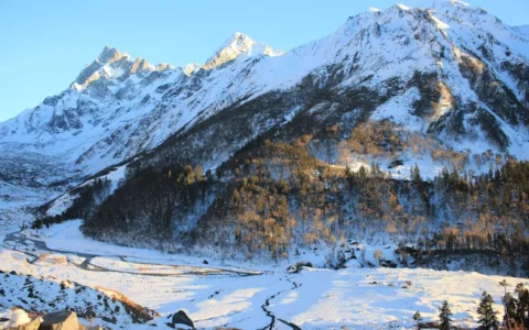
The trek begins at Song, near the town of Bageshwar, and follows the Pindar river valley through a series of traditional Kumaoni villages — Loharkhet, Dhakuri, and Khati among them — where slate-roofed stone houses and terraced barley fields reflect an agricultural way of life that has changed only gradually. Zero Point, a short additional climb above the glacier snout itself, offers an even wider view back down the valley and up towards the ice, and most itineraries build in the extra half-day required to reach it, weather permitting. The trek’s destination, Pindari Glacier’s snout at roughly 3,660 metres, is a genuinely accessible glacier viewpoint — one of the relatively few in the Indian Himalaya reachable without any technical climbing or specialised equipment. What distinguishes Pindari from many other glacier treks is the gentleness of its overall gradient combined with the sheer scale of what it reveals — the glacier snout, the surrounding cirque of 6,000-metre-plus peaks, and the moraine field between them, all reached via a trail that never demands a single brutally steep day. Dwali and Phurkiya, the trek’s higher camps, sit within striking distance of some of the most striking waterfall scenery in the Kumaon region, with several unnamed cascades visible directly from the trail as the Pindar river’s tributaries drop from hanging valleys above. Khati, the largest village on the route, sits at the confluence of the Pindar and Sunderdhunga valleys and marks the last point with any significant permanent settlement before the trail turns properly wild. Beyond Khati, the valley narrows and the forest thickens into stands of birch, rhododendron, and juniper, opening onto increasingly dramatic views of Nanda Khat and Panwali Dwar.
At 3,660 m the thin air is the real constraint on the Pindari Glacier Trek, so the upper stretch is walked slowly and altitude symptoms are reported early.
The Pindari Glacier Trek suits people who already walk but have not necessarily trekked, since its 8 days ask for stamina rather than skill. A fit beginner who prepares gets through the Pindari Glacier Trek; someone treating it as a stroll does not. Solo travellers move inside a led group on the Pindari Glacier Trek, so the pace is collective rather than personal.
Layers do more work than any single jacket on the Pindari Glacier Trek, because the temperature at 3,660 m bears little relation to the trailhead. Footwear decides the day on the Pindari Glacier Trek: loose stone and wet ground cause most slips, and a worn sole is the usual reason people struggle on the descent. Carry two litres of water each on the Pindari Glacier Trek, a small first-aid kit, a head torch for pre-dawn walking, and food already tested on a training walk.
At 3,660 m on the Pindari Glacier Trek, altitude illness is the main risk rather than the ground, so walk slowly and report a persistent headache or nausea immediately. A certified leader carries first aid and safety kit on the Pindari Glacier Trek and reviews the forecast each morning, so the plan stays provisional until conditions are known. Travel insurance that covers trekking at this altitude is worth the small extra cost and is not part of the Pindari Glacier Trek price.
The Rs 12,500 price of the Pindari Glacier Trek covers accommodation on the itinerary, the listed meals, a certified leader with support crew, applicable permits and entry fees, and the safety equipment carried. Excluded from the Pindari Glacier Trek are travel to the assembly point unless the itinerary says otherwise, personal kit and clothing, insurance, and anything the inclusions list does not name.
Standing at the glacier’s base, trekkers can see the raw, sediment-streaked ice face from which the Pindar river itself originates, along with a close view of Nanda Kot’s southern face rising directly above the ice. This has made it a longstanding favourite for trekkers who want a genuine high-altitude glacier experience without the technical or physical demands of routes further west in Himachal or Ladakh. Because the trail follows a river valley for almost its entire length, water sources are reliable throughout, and the well-established rest-house network means the trek carries less logistical uncertainty than more remote Himalayan routes — an approachable introduction to genuine glacier trekking in a part of the Himalaya still relatively free of crowds. That long history has left the route with an unusually well-established network of accommodation, meaning trekkers here move between rest houses rather than tented camps for much of the trail, a rarity in the Kumaon Himalaya.
Browsing by region or activity is often faster than reading individual pages, so start with Uttarakhand. The closest alternatives to the Pindari Glacier Trek are Har Ki Dun Valley Trek, Brahmatal Trek and Rupin Pass Trek, which suit anyone comparing dates or a slightly different grade.
The Pindari Glacier trek has a claim to being one of the oldest documented trekking routes in the Indian Himalaya — it was surveyed and written about by British officers and naturalists as far back as the late nineteenth century, and the trail infrastructure, including a series of forest rest houses at regular intervals, dates back to that same colonial-era trekking tradition. That long history has left the route with an unusually well-established network of accommodation, meaning trekkers here move between rest houses rather than tented camps for much of the trail, a rarity in the Kumaon Himalaya.
The trek begins at Song, near the town of Bageshwar, and follows the Pindar river valley through a series of traditional Kumaoni villages — Loharkhet, Dhakuri, and Khati among them — where slate-roofed stone houses and terraced barley fields reflect an agricultural way of life that has changed only gradually. Khati, the largest village on the route, sits at the confluence of the Pindar and Sunderdhunga valleys and marks the last point with any significant permanent settlement before the trail turns properly wild.
Beyond Khati, the valley narrows and the forest thickens into stands of birch, rhododendron, and juniper, opening onto increasingly dramatic views of Nanda Khat and Panwali Dwar. Dwali and Phurkiya, the trek’s higher camps, sit within striking distance of some of the most striking waterfall scenery in the Kumaon region, with several unnamed cascades visible directly from the trail as the Pindar river’s tributaries drop from hanging valleys above.
The trek’s destination, Pindari Glacier’s snout at roughly 3,660 metres, is a genuinely accessible glacier viewpoint — one of the relatively few in the Indian Himalaya reachable without any technical climbing or specialised equipment. Standing at the glacier’s base, trekkers can see the raw, sediment-streaked ice face from which the Pindar river itself originates, along with a close view of Nanda Kot’s southern face rising directly above the ice.
What distinguishes Pindari from many other glacier treks is the gentleness of its overall gradient combined with the sheer scale of what it reveals — the glacier snout, the surrounding cirque of 6,000-metre-plus peaks, and the moraine field between them, all reached via a trail that never demands a single brutally steep day. This has made it a longstanding favourite for trekkers who want a genuine high-altitude glacier experience without the technical or physical demands of routes further west in Himachal or Ladakh.
Zero Point, a short additional climb above the glacier snout itself, offers an even wider view back down the valley and up towards the ice, and most itineraries build in the extra half-day required to reach it, weather permitting. Because the trail follows a river valley for almost its entire length, water sources are reliable throughout, and the well-established rest-house network means the trek carries less logistical uncertainty than more remote Himalayan routes — an approachable introduction to genuine glacier trekking in a part of the Himalaya still relatively free of crowds.
The Pindari Glacier Trek runs for 8 days. The day-by-day itinerary above lists each stage, walking distance and overnight stay.
The Pindari Glacier Trek is rated Moderate by WDRLUST. It suits trekkers with some prior walking experience and steady fitness. Training with 45 to 60 minutes of cardio three times a week for six weeks before departure is enough for most people.
The Pindari Glacier Trek starts at Rs 12,500 per person. The price covers the inclusions listed on this page. Transport to the starting point, personal gear and anything not listed under inclusions are extra.
The route reaches approximately 3,660 m. Walk slowly, drink water and report any headache or nausea to your trek leader.
Group size is capped at Max 15 trekkers per departure, with a certified trek leader. Smaller groups mean faster head counts and more attention on the trail.
The Pindari Glacier Trek starts from the base location described in the itinerary above. WDRLUST shares exact meeting points, reporting times and transport options on booking confirmation. The nearest major access region is Uttarakhand.
The Pindari glacier sits at the head of the Pindar valley in Kumaon, around 3,660 m, and the eight-day trek follows an old pilgrim and trading route through villages. It is one of the more accessible glacier treks in India.
The trek fee is Rs 12,500 per person:
Expect Rs 30,000 to Rs 40,000 all-in. The Kumaon access is the costly part, with two full road days either side of the trek.
Rated Moderate. The trek follows a valley rather than climbing a peak, with daily distances of 8 to 12 km and gradual gain to about 3,660 m. The trail is well used and mostly well defined.
The challenge is duration rather than gradient: eight days of walking in a remote valley. The glacier viewpoint itself is a remarkable sight, with the snout and the icefall above it, and it requires no technical approach.
Kumaon’s monsoon is heavy, and the Pindar valley trail crosses streams that rise quickly. In July and August the route is genuinely compromised, and the road to Song is vulnerable to slides.
In the shoulder season you can expect afternoon rain and leeches on the forested lower sections. The upper valley drains better, but the glacier viewpoint is often in cloud.
Fly to Delhi, train to Kathgodam, drive to Song or Loharkhet, trek eight days, reverse. Thirteen or fourteen nights away from Bengaluru is the real cost in time. The road days are the reason this is a longer trip than the trek length suggests.
Explore related pages: All treks in Uttarakhand · Browse all destinations · All activities.
Drive from Bageshwar to Song, trek to Loharkhet village.
Climb through forest to Dhakuri pass, with first views of the Pindar valley.
Descend into the valley to Khati village, the last major settlement on the route.
Trek deeper into the valley through thickening forest to Dwali.
Continue up the valley, passing several waterfalls, to Phurkiya.
Trek to the glacier snout and Zero Point, then descend back to Dwali.
Retrace the route back down the valley to Loharkhet.
Trek to Song and drive back to Bageshwar.
A challenging high-altitude crossing linking the Har Ki Dun and Yamunotri valleys, culminating in a steep, technical pass…
A gentle cradle-shaped valley steeped in Mahabharata legend, ringed by the Swargarohini peaks and home to some of…
A four-day trek that opens with a mirror-still Himalayan lake and closes with a sunrise summit view spanning…